Explore
Nearby
Search
Trail Map
Commission
TNVacation.com
Get TN Vacation Guide
Search
People
Generals & Leaders
Union Soldiers
Confederate Soldiers
Eyewitnesses
Places
Battlefields
Historic Parks
History Sites
Trail Markers
Artifacts
Flags
Maps
Photos
Uniforms & Arms
Memorabilia
Timeline
1861 - Postwar
Teaching Tools
Videos
Audio
White Papers & Essays
Links
More
Trail Map
Commission
TNVacation.com
Get a Guide
Artifacts
Maps
16
Flags
25
Maps
38
Photos
45
Uniforms & Arms
70
Memorabilia
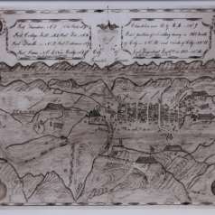
1863 Drawing of City of Knoxville
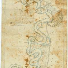
Ashport to Memphis Confederate Map, ca. 1861
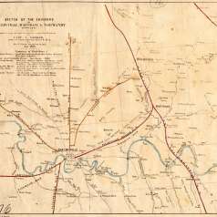
Battle of Fort Donelson Map
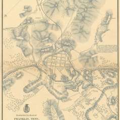
Battle of Franklin Map
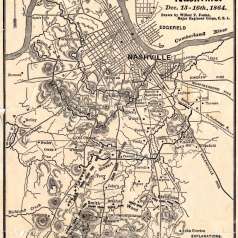
Battle of Nashville Map
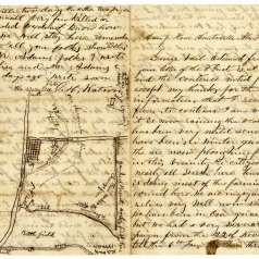
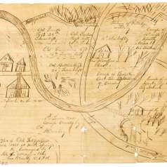
Battle of Spring Hill Letter and Map
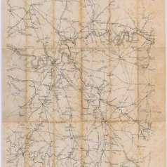
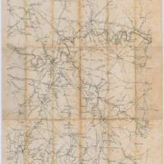
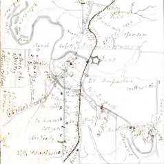
Benjamin F. Cheatham map of area southeast of Nashville, circa 1861-1865
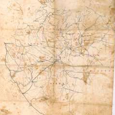
Benjamin F. Cheatham Map of Nashville and Surrounding Counties
Cheatham Map of Nashville & Surrounds, ca 1861-1865
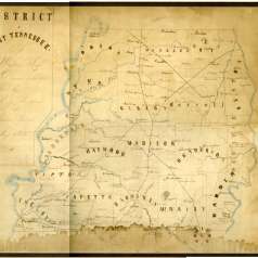
Hand-Drawn Civil War Map of West Tennessee
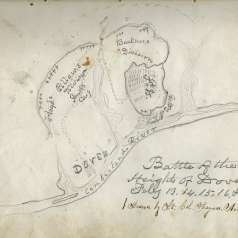
Hand-drawn Map of "Battle of Heights of Dover, Feb. 1862"
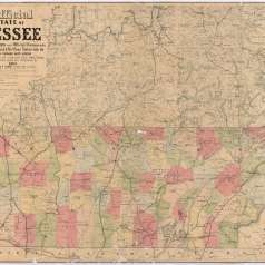
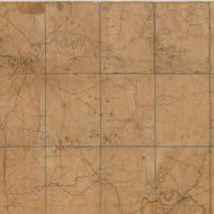
Lloyd's Official Map of the State of Tennessee, 1863
Map of Dover Battlefield
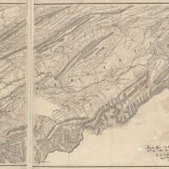
Map of East Tennessee, north of Loudon, 1864
Map of Franklin, Tennessee, 1864
Map of Knoxville during Gen. Longstreet's siege, 1863
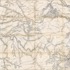
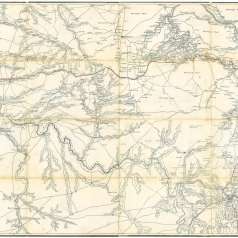
Map of Middle and East Tennessee, 1862
Map of Rebel Fortifications at Mills Springs, KY
Map of Shelbyville, Wartrace and Normandy, 1863
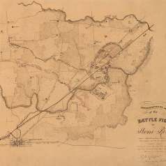
Map of Stones River Battlefield, 1863
Map of the Battle of Nashville, 1864
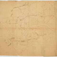
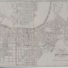
Nashville City Map 1860-1861
Union map of Middle Tennessee, 1863
Wharton map of Middle Tennessee, 1861-65
"Ashport to Memphis" Confederate Map, circa 1861